Underground Surveys have invested heavily into using industry leading data collection software programmes for some of the UK's water and sewerage companies as well construction companies, engineering consultants, industrial companies and many more. This allows us to validate and analyse our drainage reports for our clients in line with WRC MSCC4 · 5 Manual of Sewer Condition and Classification.
Underground Surveys have qualified experienced data processors who can update and report our CCTV inspections using this software for any of your projects, we can also tailor any reporting requirements to your needs.

We also work with the water industry standard InfoAsset which provides ISF and XML files back to our clients which enables planners and engineers to plan, construct, rehabilitate and maintain their water and sewer networks with a risk-based approach that leads both to greater efficiency and also to compliance with legal requirements to identify and safeguard critical assets using our CCTV data supplied. InfoAsset makes substantial enhancements to the hydraulic model build process through its seamless integration with the InfoWorks modelling suite. Automatic verification, inference and data tracking allow the quick creation of hydraulic models and maintain the full range of network information to enhance engineering decisions. Planners can apply InfoNet's analytical toolset to a consolidated and complete network data store to make logical, prioritised and cost effective decisions about its future.

All surveyors are experienced in using InfoNet Mobile which over the last 17 years for our main client Severn Trent water has enable our surveyor complete field management solution for collection data and transferring it seamlessly to the office environment in a quick and effective manner.
The additional task of collecting information on uncharted assets massively increases the complexity of the project "Using InfoNet and InfoNet Mobile as a single integrated digital solution has allowed us to adopt a streamlined approach to tracking the work to ensure it is completed on time.
Upon receiving data for each new area, we can use InfoNet to schedule CCTV Survey jobs for individual crews and synchronize this schedule with field laptops. As they record the progress of CCTV surveys, site crews are also recording the location of uncharted assets and verifying the location of existing assets.
Once a crew has completed all their jobs, they only have to synchronize their laptops with our office server to make all the data they have collected in InfoNet Mobile instantly available in InfoNet “The advanced tools in InfoNet enable us to quickly assess the connectivity and validity of the field data. This ensures that this data is validated to a high standard before it is passed back to the end client Severn Trent Water."


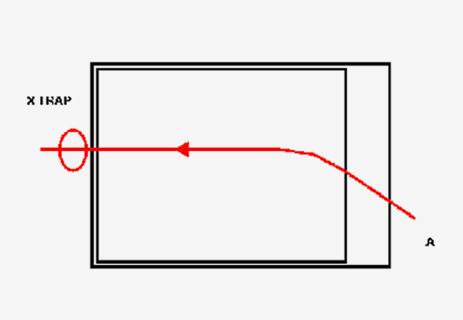
Our experienced WITA trained surveyors can critically inspect work rapidly and thoroughly using Wincan VX onsite. We can collect pipe inspection data, which allows us to generate an inspection report that is supported with a graphical pipe display with still images identifying defects. Wincan VX allows us to produce a structural and serviceability of each section of pipe report for our clients immediately to take away with them or we can arrange to manage data in our office post inspection. From a click of a button we can share with our clients using a free Wincan viewer software for you. Hard copies are available upon request.
All surveys are subject to quality control and are validated using industry standard guidelines and validation software to ensure every survey completed is with consistency through report.

Sewer Viewer™ is the UK's first cloud-based storage and management solution for underground CCTV inspections. Utility companies are using the system to share video and related inspections files across their business. No more DVDs and hard drives, no more long delays waiting for inspections to come back from suppliers. With a comprehensive reporting and analysis suite built into the system, a supplier validation tool, intuitive reporting, network mapping of assets, mobile optimisation and much more Sewer Viewer™ is changing the way CCTV data is managed.

This software is used for the reactive work we carry out for Amey, this app enables company supervisors to collect real-time data and photos from different locations simultaneously and remotely, which reduces the amount of travel that improves security and employee well-being, along with CO2 emissions and the environmental impact. In addition, this app also helps eliminate time-consuming administrative paperwork for the entire account, giving individuals more time to carry out 'real supervision' and helping improve the customer experience.

MapInfo is a desktop geographic information system (GIS) software product produced by Precisely (formerly: Pitney Bowes Software and MapInfo Corporation) and used for mapping and location analysis. MapInfo Pro allows users to visualize, analyze, edit, interpret, understand and output data to reveal relationships, patterns, and trends. MapInfo Pro allows users to explore spatial data within a dataset, symbolize features, and create maps.
All our office data processors and site surveyors are experience in using this software which helps them to interrogate data assets in various workspaces.


Underground Surveys (UK) Limited
Marsh House Lane
off Rylock Close
Warrington
WA1 3QU
That's why you can contact us by telephone, fax, by post or email and one of our experienced team will answer your questions as soon as they can.